


DeerCast: Weather, Maps, Track
4.61.87K Reviews
App Specs
- Version
- 4.4.9
- Updated On
- License
- Free
- Downloads
- 500,000+
- Developer
- GSM Outdoors
- Categories
- Weather
- Platform
- Android, iOS
Screenshots
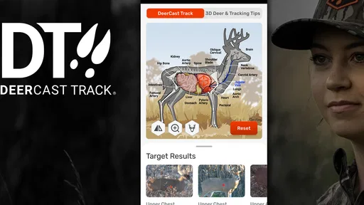
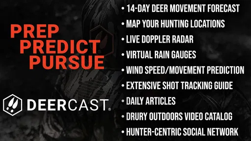
 Analysis by AppCompare
When I plan a hunt, I don’t want a pretty forecast that leaves me guessing about what the conditions mean in the field. I want to know whether the weather, timing, and a particular place make a trip worth planning. That’s the idea behind DeerCast: Weather, Maps, Track, a hunting-focused weather app from GSM Outdoors. I find the focus useful, but I also think it’s important to treat a prediction as one input—not a promise about what wildlife will do.
A hunting forecast is helpful, but not a guarantee
Most general weather apps are good at answering practical questions such as whether rain is expected or how the temperature will change. DeerCast aims at a narrower decision: how conditions may relate to deer movement. That framing can help me think beyond “Will it rain?” and consider whether a planned outing fits the forecast. The distinction matters, because the app can organize information for a hunting decision without removing the uncertainty of hunting itself.
In everyday use, I’d check the forecast before choosing when to leave, then look again before committing to a route or stand. If the outlook changes, I can reconsider rather than treating an earlier plan as fixed. That is a more sensible way to use a movement prediction than relying on a single score or moment as if it were a guarantee. Weather is only one part of a hunt, and local conditions and personal judgment still matter.
What to check before heading into the field
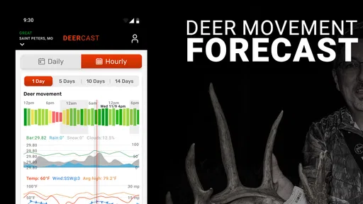
The weather tools described for DeerCast include hourly forecasts, wind direction, and barometric pressure. I’d use those details together instead of focusing on one headline forecast. For example, an hourly view can help me compare an early start with a later one, while wind direction can make a familiar location feel less suitable than it did on a previous visit. The practical benefit is not that the app makes the decision for me; it helps me notice the details I might otherwise overlook.
A useful habit is to check conditions at two points: while planning at home and again shortly before leaving. That gives me a chance to spot a change and adjust expectations. I would also avoid interpreting a favorable movement forecast as a reason to ignore ordinary preparation, changing weather, or safe travel. The app is most useful as a planning aid, not as a substitute for awareness in the field.
Understanding the Basics
DeerCast is not just your average weather app. It’s designed specifically for hunters by hunters, and it combines weather forecasts with hunting predictions to give you the best shot at success. The app offers a unique blend of tools, including weather data, maps, and even a deer movement forecast. It’s like having a personal hunting assistant in your pocket.
Weather Forecasts Tailored for Hunters
First off, the weather features in DeerCast are pretty impressive. You get hourly forecasts, wind direction, barometric pressure, and more. It’s all the information you need to make smart decisions about when to head out. What’s cool is how the app integrates this data into a deer movement prediction system. It uses the weather data to predict when deer are most likely to be active. So, instead of just knowing it’s going to rain, you know if it’s a good time to be out there or if you should wait it out.
Worth Reading Before You Choose

EA SPORTS FC Mobile 26 Is a Bigger Football Game, but It Takes Time

Flipboard Shows What News Apps Must Do Beyond the Feed

Switching to Android Auto Means Rethinking Your Driving Routine

Google Calendar Makes a Crowded Week Easier to Manage

Ludo King Makes the Most of the Minutes Between Plans

Baby Panda World Brings Quick Play to Modern Phones, but Its Game Library Feels Busy
Mapping and Tracking Like a Pro
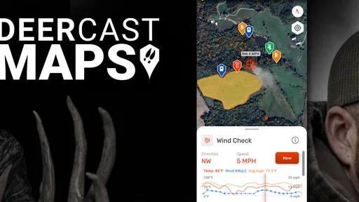
The mapping feature is another highlight. It’s interactive and lets you geo-tag locations, track your movements, and even mark where you’ve spotted deer. This is super handy for keeping track of your favorite hunting spots and planning your routes. Plus, the app’s tracking capability means you can easily backtrack your steps or share your location with your hunting buddies.
Make field notes useful, not cluttered
Marking a deer sighting is more useful when the note helps me remember why that place mattered. I’d keep entries brief and consistent—for example, identify the spot and add a detail I’ll actually use later, such as the wind direction or the time I passed through. A map filled with meaningful markers can reveal patterns across visits; a map crowded with vague pins is much harder to act on.
I’d also distinguish observations from plans. A location where I saw deer is not automatically the best place to return, and a route I tracked once may not suit different conditions. Treating map marks as a record rather than a set of instructions keeps the feature grounded. Before relying on any tracking tool, I’d check that my phone is ready for a full outing and keep a separate navigation or safety plan appropriate to the area.
Community and Connectivity
Another aspect I love about DeerCast is the community feel. You can connect with other hunters, share experiences, and even get tips from seasoned pros. There’s a real social element here that makes it more than just an app; it feels like a community. This connection can be invaluable, especially when you’re trying to improve your hunting skills or just want to share stories from the field.
Who gets the most from this combination
I see the strongest fit for hunters who already think about wind, timing, and location, and want their planning tools collected in one place. Someone learning to keep better records may also benefit from pairing forecast checks with map markers, because each outing can become a more useful reference for the next one. The app’s purpose is specific enough that it may suit a regular whitetail hunter better than a person who only wants a broad forecast for commuting, gardening, or general travel.
There are good reasons to choose a different tool, too. If your main need is a simple glance at rain and temperature, a standard weather app may be quicker and less specialized. If your priority is navigation rather than hunting forecasts, a dedicated mapping or navigation option may be a better fit for that task. I would not expect one hunting app to replace every tool I use outdoors; DeerCast makes more sense as a focused companion than as a universal field-safety solution.
A realistic planning routine
Imagine I have a free morning and need to decide whether it is worth setting an alarm. The night before, I can compare the hourly forecast and wind direction with the location I have in mind, then use the movement outlook as another factor. If conditions look less promising, I can change the plan without treating that as a failed forecast. In the morning, I can check again, record where I go, and leave a marker if I see something worth remembering. The value is in making a series of small, informed choices—not in expecting the app to guarantee a sighting.
That routine also points to a useful trade-off: more information helps only when I have time to interpret it. A hunter who checks forecasts obsessively may end up changing plans for every small shift, while someone who never revisits the forecast may miss a meaningful change. I’d use a simple threshold of my own—decide which conditions would actually change my plans, then focus on those. That keeps the app supportive instead of letting it dictate the day.
Trust, choices, and practical limits
Because this app can involve maps, location-related use, and a social element, I would pause to review the permissions and visible sharing choices presented on my device before using those functions. I don’t assume that a feature’s presence tells me exactly how information is handled. A careful user can decide which capabilities are needed for a particular outing and avoid enabling or sharing anything they do not want to use. For a hunting partner, I’d agree in advance on when location sharing is useful rather than treating it as something that must remain on all the time.
That is also why I’d separate personal field notes from anything I choose to share with a community. A pin that helps me remember a private spot may not be information I want to post publicly. Before adding detail, I’d ask whether it helps my own planning, whether it is appropriate to share, and whether I can leave it out without losing the value of the record. Those small choices make the app feel more manageable and keep the social features on my terms.
DeerCast is free to install, with optional in-app purchases priced from $29.99 to $74.99 per item, so I’d explore the available experience and decide whether any paid option fits my needs before spending. Its average rating is 4.5 from around 5,500 ratings, alongside roughly 1,900 written reviews, and it has over 500,000 installs. Those figures suggest a substantial audience, but they don’t tell me whether the app’s particular approach will suit my habits. It is rated for Everyone 10+, runs on Android 8.0 or later, and version 4.3.5 is the current version. The app was released on August 23, 2018.
Intuitive User Experience
The developers did a fantastic job with the user interface. It’s intuitive and easy to navigate, which means you’re not fumbling around the app trying to find what you need. Whether you’re a tech-savvy hunter or someone who just wants straightforward functionality, DeerCast has you covered. The layout is clean, with all the essential features just a tap away.
My cautious verdict
I like the idea of bringing a hunting-oriented forecast together with maps and tracking, especially for someone who wants to build a more deliberate planning routine. I would recommend it to a hunter who values those connected tools and is comfortable making the final call independently. I’d be more hesitant to recommend it to someone seeking only a basic weather check, someone who needs a dedicated navigation solution, or anyone expecting a movement prediction to remove uncertainty.
Final Thoughts
In a nutshell, DeerCast: Weather, Maps, Track offers a comprehensive suite of tools that can seriously enhance your hunting experience. Its weather and deer movement predictions are spot-on, the mapping and tracking features are robust, and the community aspect adds an extra layer of engagement. It’s a must-have for anyone who’s passionate about hunting.
So, if you’re looking to up your game and make the most out of your hunting trips, give DeerCast a shot. You might just find that it’s the edge you’ve been looking for.
Pros
- Detailed weather forecasts for hunters.
- Interactive maps with tracking features.
- Customizable notifications for conditions.
- User-friendly interface design.
- Community insights and tips.
Cons
- Limited offline functionality.
- Subscription required for premium features.
- Heavy battery usage in tracking mode.
- Occasional app crashes reported.
- High data consumption with maps.
FAQs for DeerCast: Weather, Maps, Track
What is DeerCast and how does it enhance my hunting experience?
DeerCast is an innovative app designed for hunters, providing detailed weather forecasts, maps, and tracking features to optimize hunting trips. It offers real-time data on deer movement patterns, personalized predictions, and advanced mapping tools. By using this app, hunters can plan more effectively, increasing their chances of a successful hunt.
How accurate are the weather forecasts and deer movement predictions in DeerCast?
DeerCast uses cutting-edge technology and data analysis to provide highly accurate weather forecasts and deer movement predictions. The app analyzes various factors such as temperature, wind direction, and moon phases to deliver precise insights. While no prediction can be 100% accurate, DeerCast is renowned for its reliability among hunters.
Is DeerCast compatible with both Android and iOS devices?
Yes, DeerCast is available for download on both Android and iOS platforms. The app is designed to work seamlessly across a variety of devices, providing a user-friendly interface and quick access to all its features. Users can download it from the respective app stores and enjoy its full range of services.
Does DeerCast offer a free version, or is it subscription-based?
DeerCast offers both free and subscription-based versions. The free version provides basic features, while the subscription unlocks premium services such as enhanced mapping, advanced predictions, and ad-free usage. This tiered approach allows users to choose the level of service that best suits their needs and budget.
What kind of mapping features can I expect from DeerCast?
DeerCast provides comprehensive mapping features that include topographical maps, satellite imagery, and customizable layers. Users can mark locations, track routes, and access real-time weather overlays. These tools are designed to assist hunters in navigating terrains effectively and making informed decisions based on environmental conditions.


